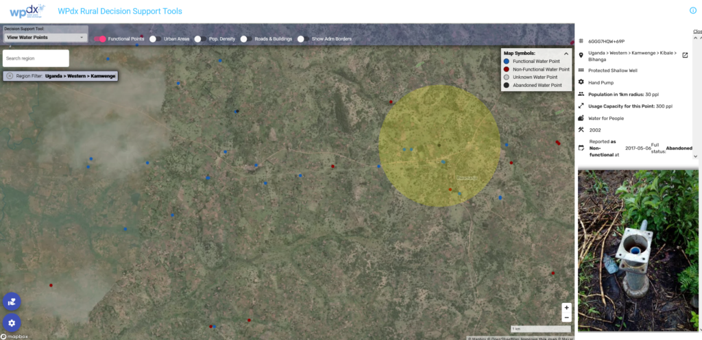
We are excited to share some new features and updates which have been added to the WPdx decision support tools app. Please take a few moments to check out the following:
New search feature
If you know the exact location you are interested in exploring, you can now type in the name of the country, region, district or sub-district (depending on what boundary information is available in WPdx) directly into the search bar in the upper left corner.
As you type, a list of options containing the requested text will appear below the text box. The video below shows how you can enter a country name (ie, Sierra Leone), a region (Northern), a district (Bombali) or a sub-district (Sella Limba) area and then zoom to that selected geography.
Depending on how unique the name of the area interest is, users may need to add some additional detail (i.e., Northern is a common administrative division name, so users may need to include the country of interest).
Users can also still use our existing ‘Filter by Region’ tool by clicking on the gear icon in the lower left corner and following the prompts.
Identification of water points which are abandoned or decommissioned
The #status_id parameter from the WPdx Data Standard requires users to provide a simple “Yes” or “No” to the question “Identify if any water is available on the day of the visit, recognizing that it may be a limited flow?”.
While this simple classification is useful to compile and harmonize data which may have different thresholds for partial functionality, etc. it misses out on identifying water points which are non-functional due to abandonment or decommissioning. These designations are important, especially for analyses which focus on identifying priority water points for repair/rehabilitation.
Using the #status parameter, which is an open text field where users can provide additional information about the condition of the water point, we have classified water points as one of the following: Functional, Functional but in need of repair, Non-Functional, Non-Functional due to dry season, Abandoned/Decommissioned, and Other. We will continue to refine this cleaning process, and are in discussions with the WPdx Working Group to edit to the WPdx data standard to include ‘abandoned/decommissioned’ as a response to the #status_id parameter.
The Abandoned/Decommissioned points are still visible in the tools as black points (instead of red or blue points), but are not considered for the Administrative Region, Rehab Priority or Service Gap Identification analyses. The classifications are included in a new parameter “status_clean” which is available in the WPdx+ dataset.

Updated maximum capacity figures
For each water point, WPdx estimates the number of ‘likely users’ (for functional water points) or ‘users who could gain access’ (for non-functional water points) using high density population datasets from Meta (Facebook) and relative distance calculations if population centers have more than one water point within a 1km distance. This approach ensures that no one is double counted and that we have a reasonable estimate of how many people are using each specific water point. There is a maximum number of people who can be served by a single water point which is dependent on the water point technology. These maximum capacity figures vary by country.
Initially, WPdx tools utilized maximum capacity values primarily from the Sphere Guidelines. However, as these are designed as minimum standards during humanitarian assistance response, the figures were often higher than national regulations for normal conditions. Through a consultative process with the WPdx working group and other external sector leaders, we have reduced the maximum capacities to the following figures:
- 1000 people per mechanized (powered) well
- 300 people per hand pump [most hand pumps except for those with listed lower capacities]
- 250 people per tap (tapstand, kiosk)
- 250 people per protected spring
- 50 people per rainwater catchment system
- 50 people per rope and bucket system/EMAS Pump/Rope Pump
These figures are intended to be reasonable estimates for a global algorithm. However, it may be possible to make make additional updates and customizations based on local regulations.
Please reach out to info@washhealthdata.org for more information.
